









|
RCBJ-Audible (Listen For Free)
 |

Residents Protest the Loss Of 27.6 Acres of Forest and Over 1,600 Trees To Clear Way For Congers Warehouses & Fast Food Restaurant
ANALYSIS
The removal of more than 1,600 trees on a 40-acre site in Congers to make way for a half-million square feet of warehouses has local residents and environmental organizations up in arms.
A rally at Clarkstown Town Hall before the Clarkstown Planning Board meeting tomorrow (Wednesday) is planned to object to the loss of 27.6 acres of forested land that hosts mature trees and wildlife. The protest is scheduled to take place prior to a Planning Board meeting at 7 pm in Clarkstown Town Hall where Brooklyn-based Vanta Developers, the developer of Cedar Corners, will present its Supplemental Draft Environmental Impact Statement (DEIS). The project proposes three large warehouses on a planned 16-lot assemblage off Meola Road in Congers.
Vanta last appeared before the Clarkstown Planning Board in June, where it presented the Supplemental DEIS, triggering the public hearing to review the update.
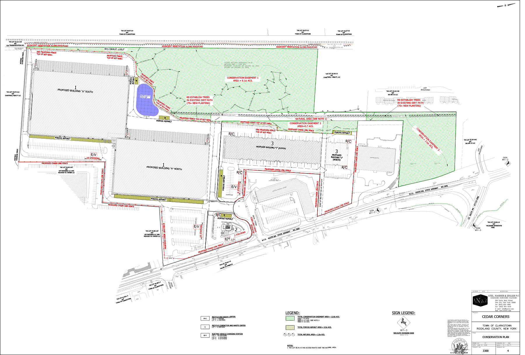
Vanta’s plan is to merge 16 tax lots, then subdivide them into three parcels. Two of the parcels will have commercial buildings. One with 380,780 square feet of warehouse/office space, 72 loading berths, and 394 parking spaces. The other will have two warehouses totaling 180,740 square feet and 199 parking spaces. The third lot is set aside for a fast-food, drive-thru restaurant with 34 parking spaces.
The property is located on more than 40 acres of CO, COS and LS zoned land on the west side of NYS Route 303, bordered by the CSX railroad to the west and an existing shopping center and several dwellings off Meola Road in Congers. But the site is designated by New York State as a “significant natural community,” populated with oak and tulip forests, and is part of a 175-acre contiguous habitat for wildlife. The site also has 5.56 acres of wetlands as well as wetlands contiguous to adjacent sites.

The area in Congers along Route 303 is also designated as a “Disadvantaged Community” under the NYS DEC guidelines, requiring a more detailed analysis of the environmental impacts to ensure that the community benefits from the state’s transition to cleaner, greener sources of energy, reduced pollution and cleaner air, making the mitigation of air quality issues from diesel sources and trucking more important.
The developer has outlined a “Conservation Plan,” that leaves a 5.56 acre wetland on the site undisturbed, allows for conservation easements on 12.8 acres (inclusive of the wetlands), a natural area of about one acre, and about a half-acre of porous asphalt. The conservation plan will also add about 75 trees adjacent to the buffer around the wetland to supplement existing vegetation.
The site currently has 2,409 trees existing on the site, of which only 794, or one third, are to remain under the Tree Preservation Plan. According to a recent revision to the plan, the developer is going to plant 603 replacement trees, both hardwood and softwood, at the site.
It can take between 20 and 40 years for a newly planted tree to offset the carbon after loss of a mature tree.
The loss of habitat is a concern for local organizations including the Sierra Club and Rockland Water Watch. Clarkstown resident Peggy Kurtz is part of group of residents circulating flyers and posting on social media under the banner of “STOP ANOTHER MASSIVE WAREHOUSE PROJECT IN CONGERS.”
Clarkstown resident Barbara Pfingst said, “The overwhelming number of warehouses we have are hurting the our community. They provide few jobs, increase congestion and truck traffic, as well as create outsized environmental concerns, such as air and water pollution. They’re enormous heat islands. We don’t need another warehouse in Congers..”
The developer’s expert, Ecological Analysis LLC, says the project site is not a “town-identified” ecological corridor as per Clarkstown’s Comprehensive Plan Update. It says the site is classified as a “forest block” rather than a “mapped corridor,” and that it is largely disconnected from other nearby forest blocks. It refers to the site as a “functionally isolated woodland and wetland fragment,” but acknowledges that limited wildlife movement may occur in the surrounding developed landscape.
It says no further study is necessary as the projects “Conservation Plan” supports any potential for wildlife movement anticipated north of the developed area toward a potential crossing at NYS Route 9W and NYS Route 303, where the developer is proposing wildlife signage to alert motorists.
Environmental concerns rarely move the Clarkstown Planning Board, which generally focuses mainly on traffic and truck issues. On a recent Zoom call, about a dozen residents discussed the economic impact of yet-another warehouse in Clarkstown, when so many in Clarkstown and Rockland County sit vacant or partially vacant.






The buildings and parking areas will create 24.6 acres of impervious surface, impacting run-off to nearby streams, including Tom’s Brook (located to the west of the site), which drains toward Lake DeForest and the Hackensack River. The developer says its project will have no “significant adverse impacts to water resources” because it is not located over an aquifer and no on-site wells are proposed. It relies on its SWPPP (Stormwater Pollution Protection Plan) as mitigating any adverse impacts to nearby streams from runoff from the impervious surfaces.
Aside from the loss of forest and impacts of local water resources, the Supplemental DEIS also minimizes concerns about air quality and pollution. Rockland County only has one air quality monitoring station out near Conklin Farm, making monitoring the impacts of diesel emissions from any one project difficult or impossible.
Residents on social media and Zoom meetings have been strategizing over how to address the Supplemental DEIS.
Former Town Councilman Peter Bradley, in a letter to the Planning Board, wrote: “The noise and air pollution from seventy-two tractor trailers potentially idling while their stock is being loaded daily will significantly reduce the air quality for all of Congers and beyond.”
The developer discounted those concerns, saying Route 303 is a dedicated truck route, and the project site is located adjacent to existing commercial operations, high-traffic roadways, and similar land uses.
The developer says that additional vehicular traffic from the project will not result in any degradation in air quality, but bases that conclusion on the assumption that regulatory measures like New York’s Zero Emission Vehicle program and EPA NOx standards will reduce vehicle emissions over time. The Zero Emission Vehicle (ZEV) program for trucks is a policy rule that requires truck makers to build and sell more electric or hydrogen trucks. It aims to cut down dirty air and pollution from big vehicles. The state program has had a slow start, and the state cannot enforce penalties or violations until 2029. Electric and hydrogen medium- and heavy-duty trucks make up less than 1% (approximately 0.5%) of total truck registrations and active commercial vehicles on the road in New York, according to the International Council on Clean Transportation.
Vanta’s traffic study says the project will generate approximately 194 weekday A.M. peak-hour trips and 206 weekday P.M. peak-hour trips. The intersection anticipated to experience the greatest project-related traffic volume is the site access intersection at NYS Route 303/Meola Road, where plans include the addition of a northbound left-turn lane on Route 303 and signalization.

The site is also mapped by New York State as a Disadvantaged Community (DAC) as established by the Climate Justice Working Group (CJWG) under The Climate Act. The developer dismisses the significance of the designation. It says “the specific conditions at and around the Project Site do not reflect the environmental burdens or vulnerabilities typically associated with DAC criteria. Therefore, the DAC designation appears not to be substantively applicable to the Project Site or the proposed development.”
The Planning Board will have to determine what weight to give to the developer’s position as the NYSDEC has already declared the area as a DAC, warranting a heightened analysis of potential impacts on the community.
According to Vanta’s website, it says it is “conscious of our impact on both the environment and social fabric of the communities we’re privileged to be in, and strive to make a positive difference in every way we can. Our developments incorporate cutting-edge sustainable features designed to minimize our footprint, including solar panels, electric charging stations, and green material.”
Plans include installation of 4,650 solar panels at the site and 30 EV charging stations.
After the DEIS is accepted, the Planning Board as lead agency is responsible for gathering comments and prepares the Final EIS. It must adopt a formal, written set of findings, evidencing that the Board took a “hard look” at environmental consequences, balanced social and economic factors, and chose an action that minimizes environmental harm to the maximum extent practical.
Once findings are adopted, the Board can officially approve, deny, or place conditions on the project permits, concluding the SEQR review process.
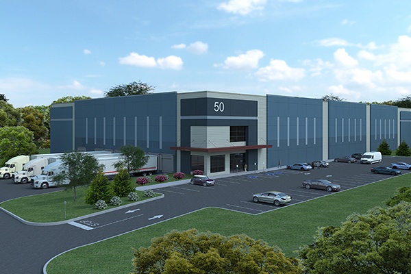
(Image from Vanta Developer website depicts a similar project by the same developer.)